Eastern Shore
drone services
photography
& videography
Delivering high-quality aerial imagery and video for real estate marketing, boat sales, and a wide range of commercial and creative needs on Maryland’s Eastern Shore.
find your vantage point
At Sightlines we combine local knowledge of Maryland’s waterways and landscapes with professional, FAA-compliant drone operations to provide clear, compelling visuals that help clients showcase properties, vessels, and projects from the best possible perspective.
-
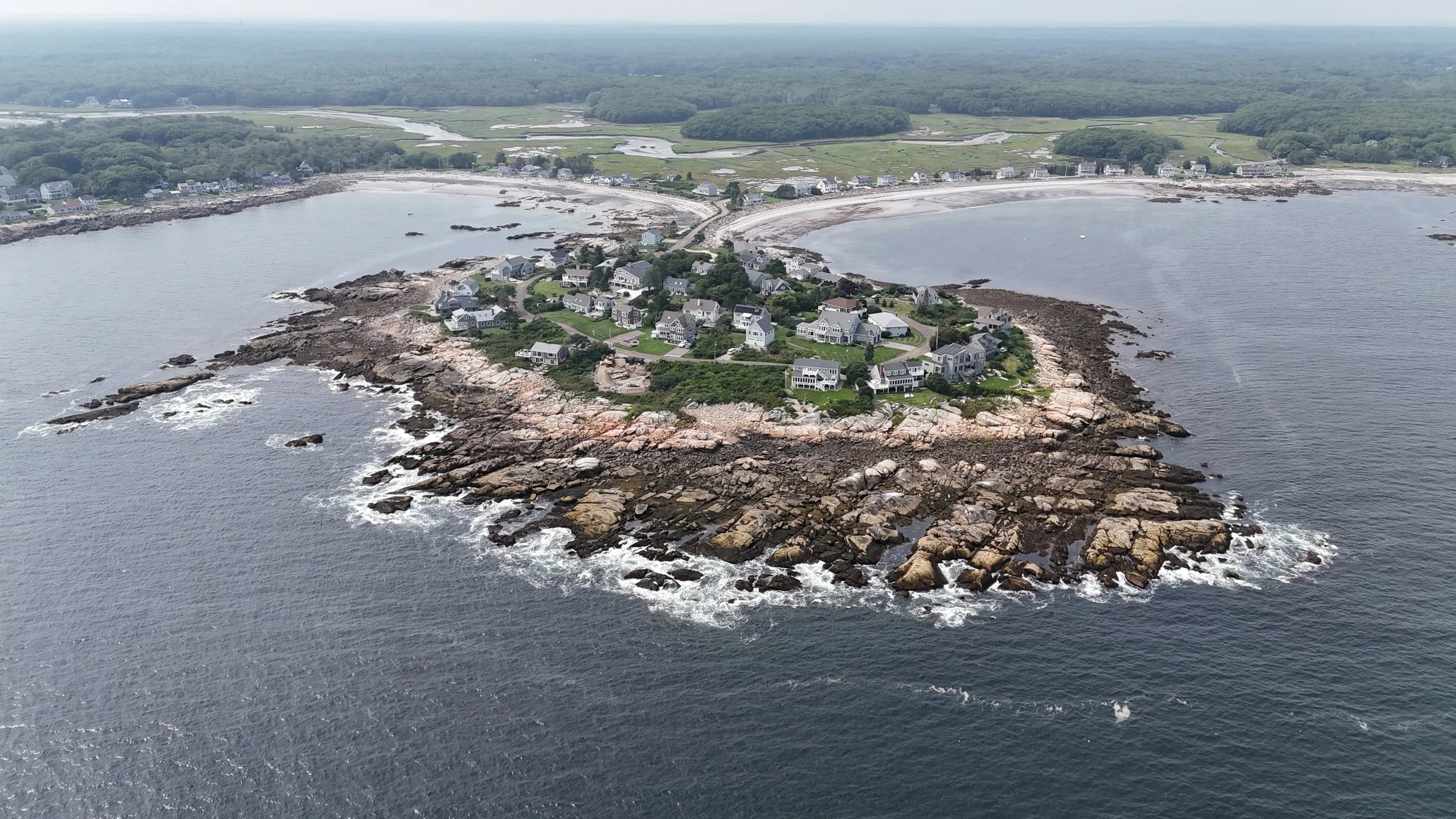
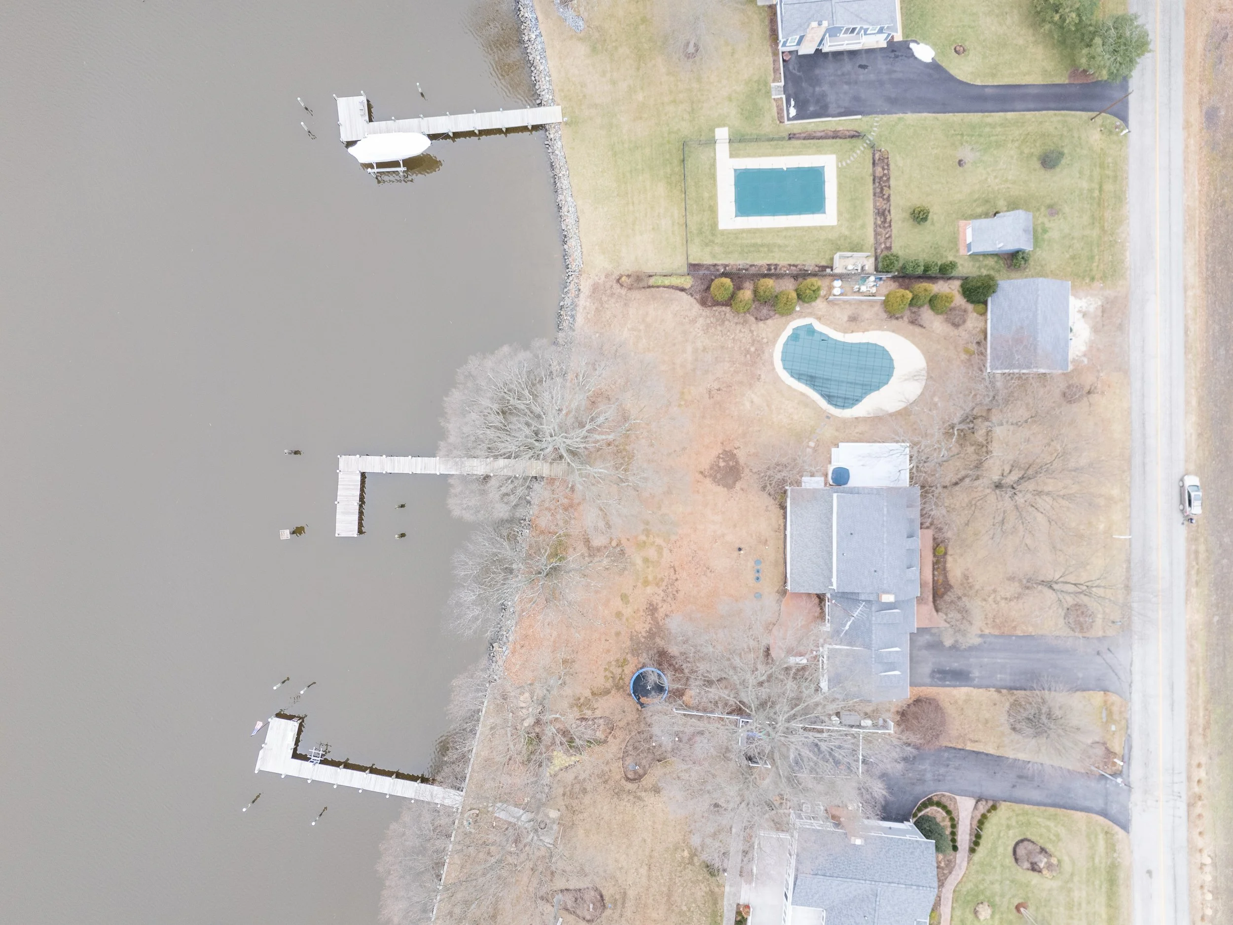
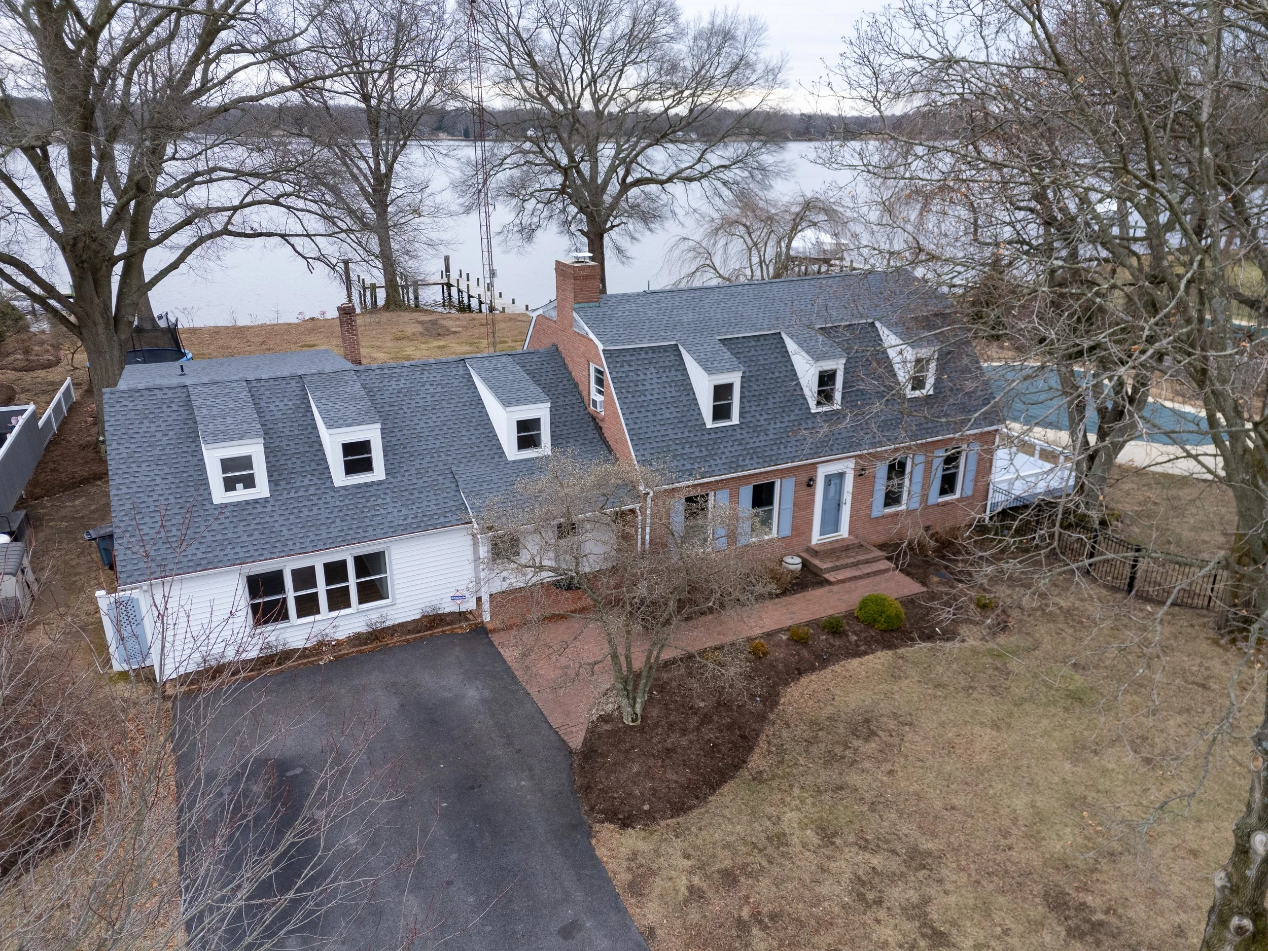
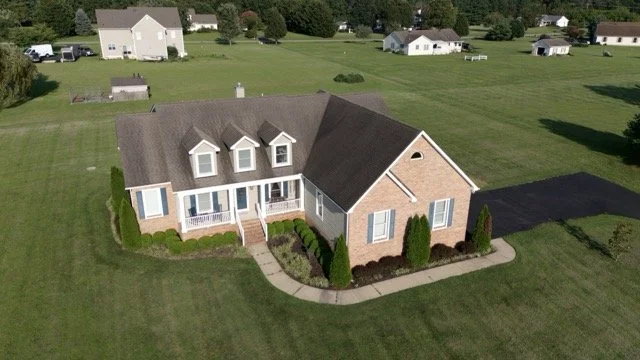
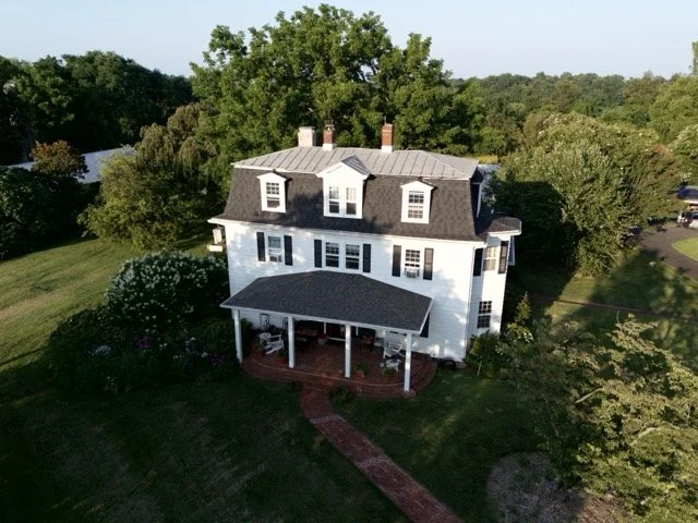
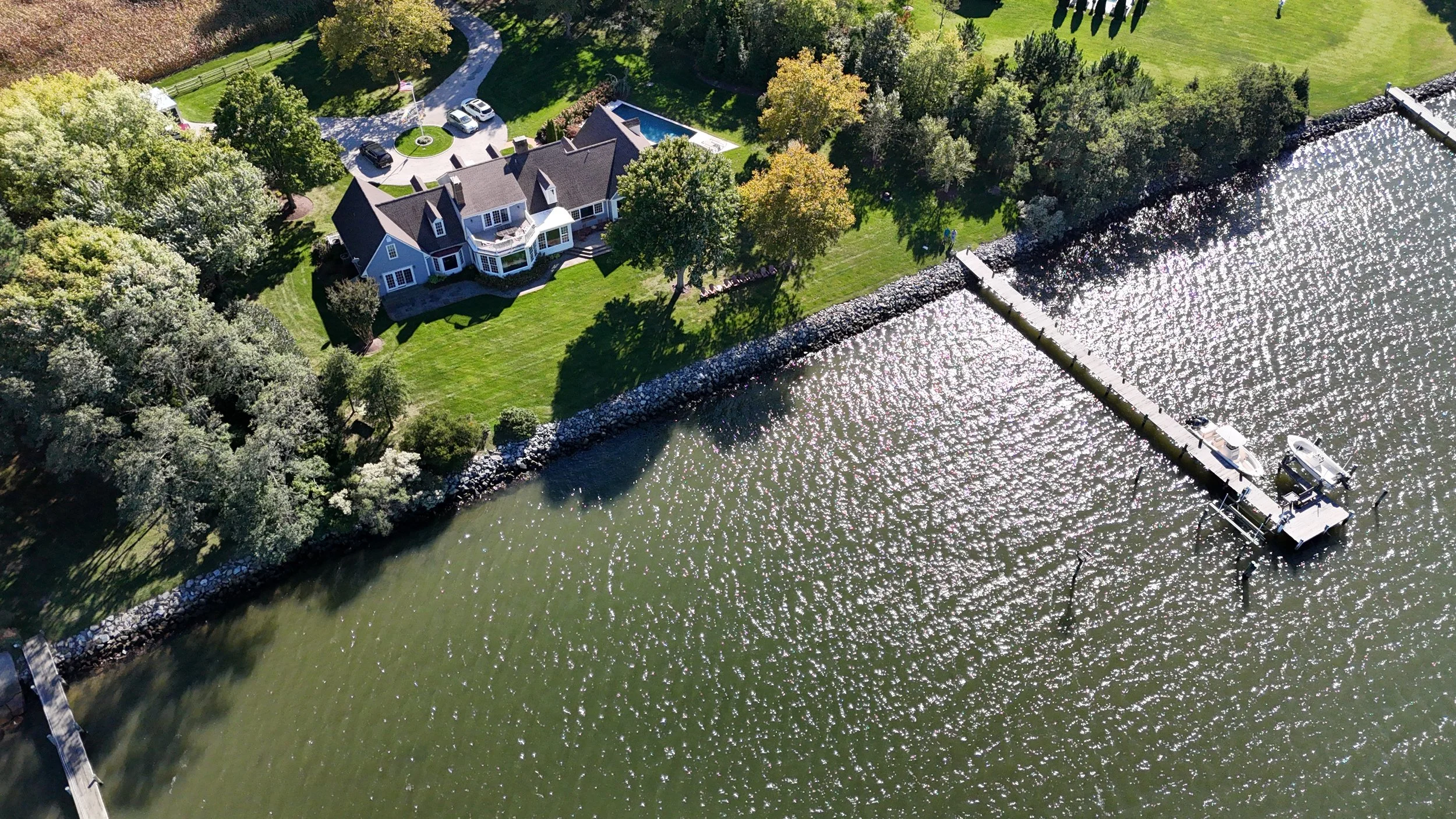
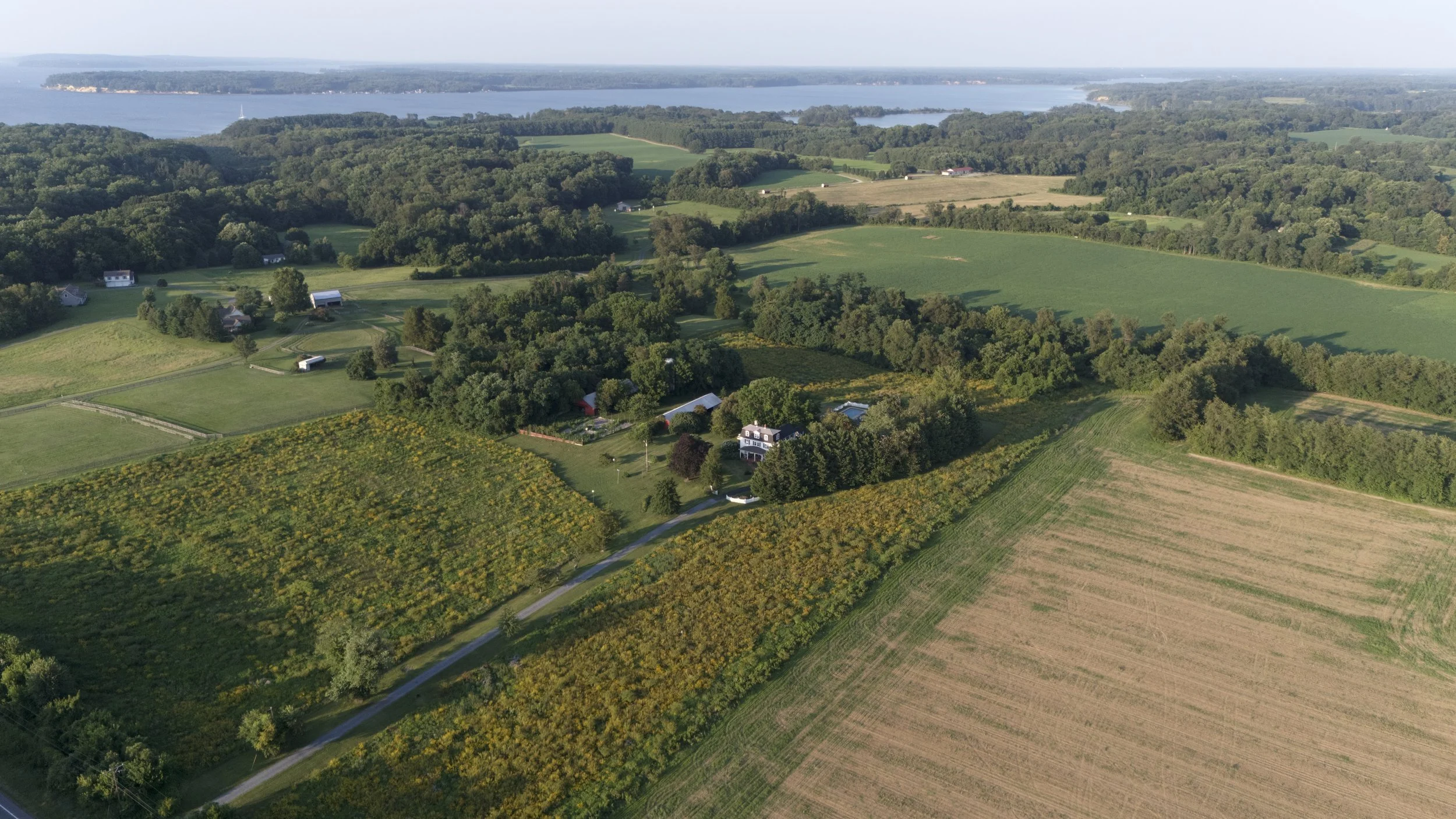
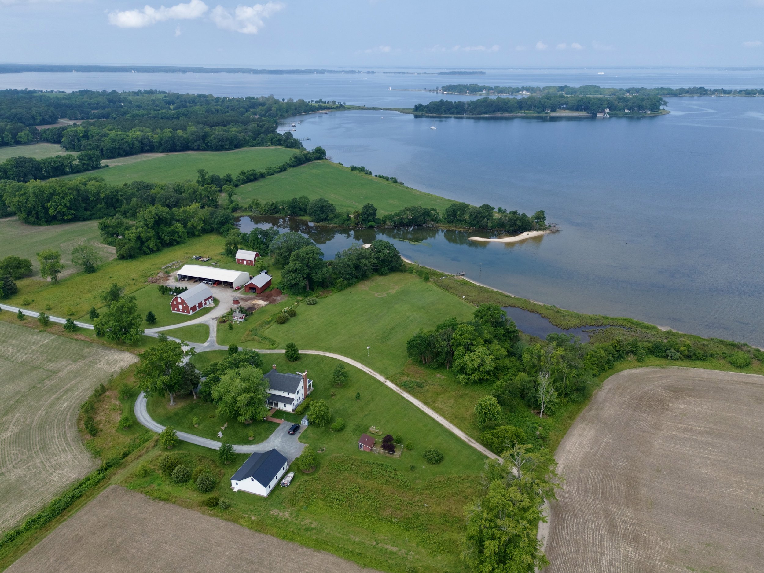
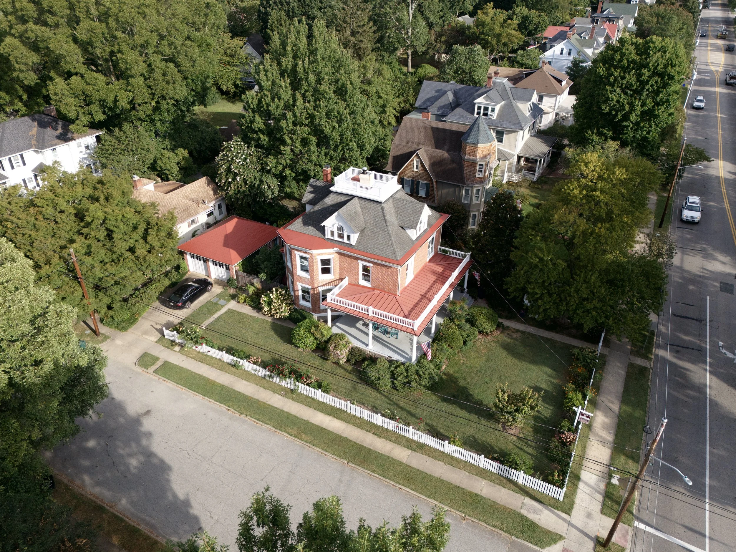
Sightlines Aerial provides professional drone photography and video services to help real estate listings stand out in a competitive market. Using high-resolution aerial imagery, we capture properties, waterfronts, landscapes, and surrounding amenities from perspectives that ground-based photography cannot achieve.
Our flights showcase scale, setting, and access—highlighting features like shoreline frontage, acreage, proximity to water, and neighborhood context. This helps buyers understand the full value of a property before ever stepping on site.
All operations follow FAA regulations and industry best practices, ensuring safe, reliable, and high-quality visuals that support faster sales and stronger marketing results.
-
Sightlines Aerial provides professional drone inspection services for roofs, chimneys, and other hard-to-reach structures. Using high-resolution aerial imaging, we safely capture detailed views of areas that are difficult, dangerous, or costly to access by ladder or lift.
Our inspections support homeowners, contractors, and insurance providers by documenting storm damage, wear, leaks, and structural concerns with clear, accurate visuals. This reduces risk, speeds up assessments, and improves claim and repair planning.
All flights follow FAA regulations and safety standards, delivering reliable documentation that saves time, lowers costs, and provides confidence in every inspection.
-
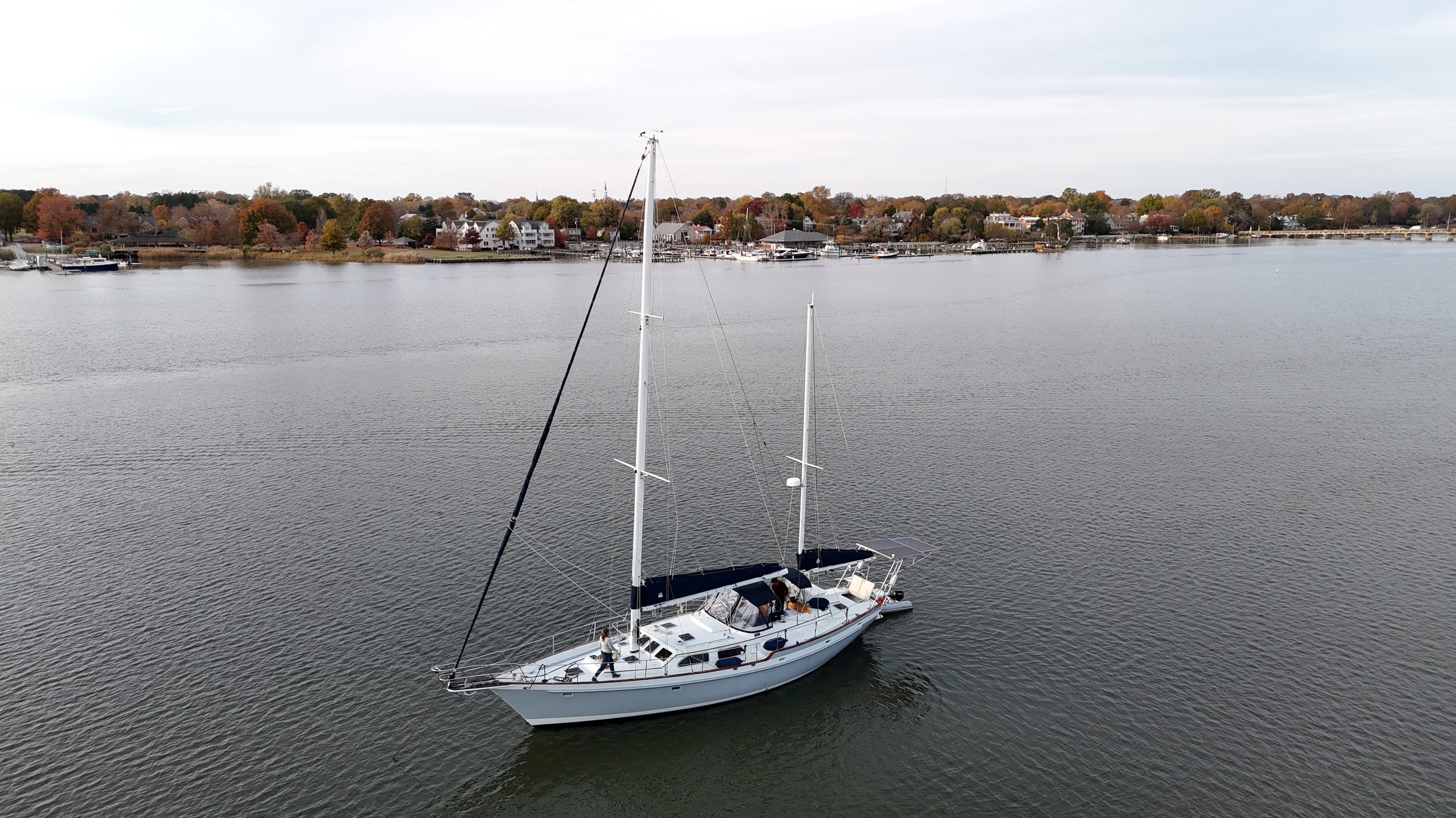
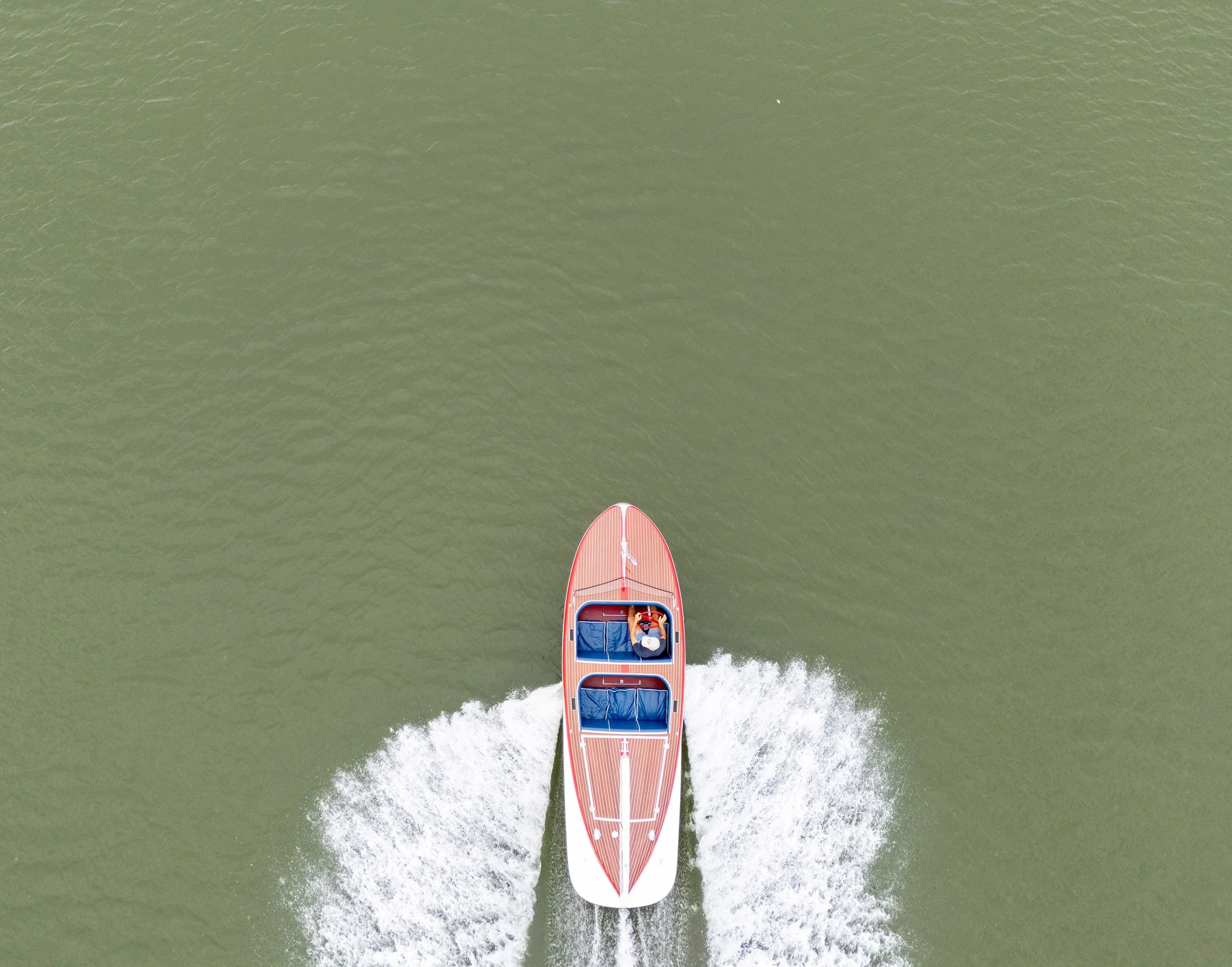
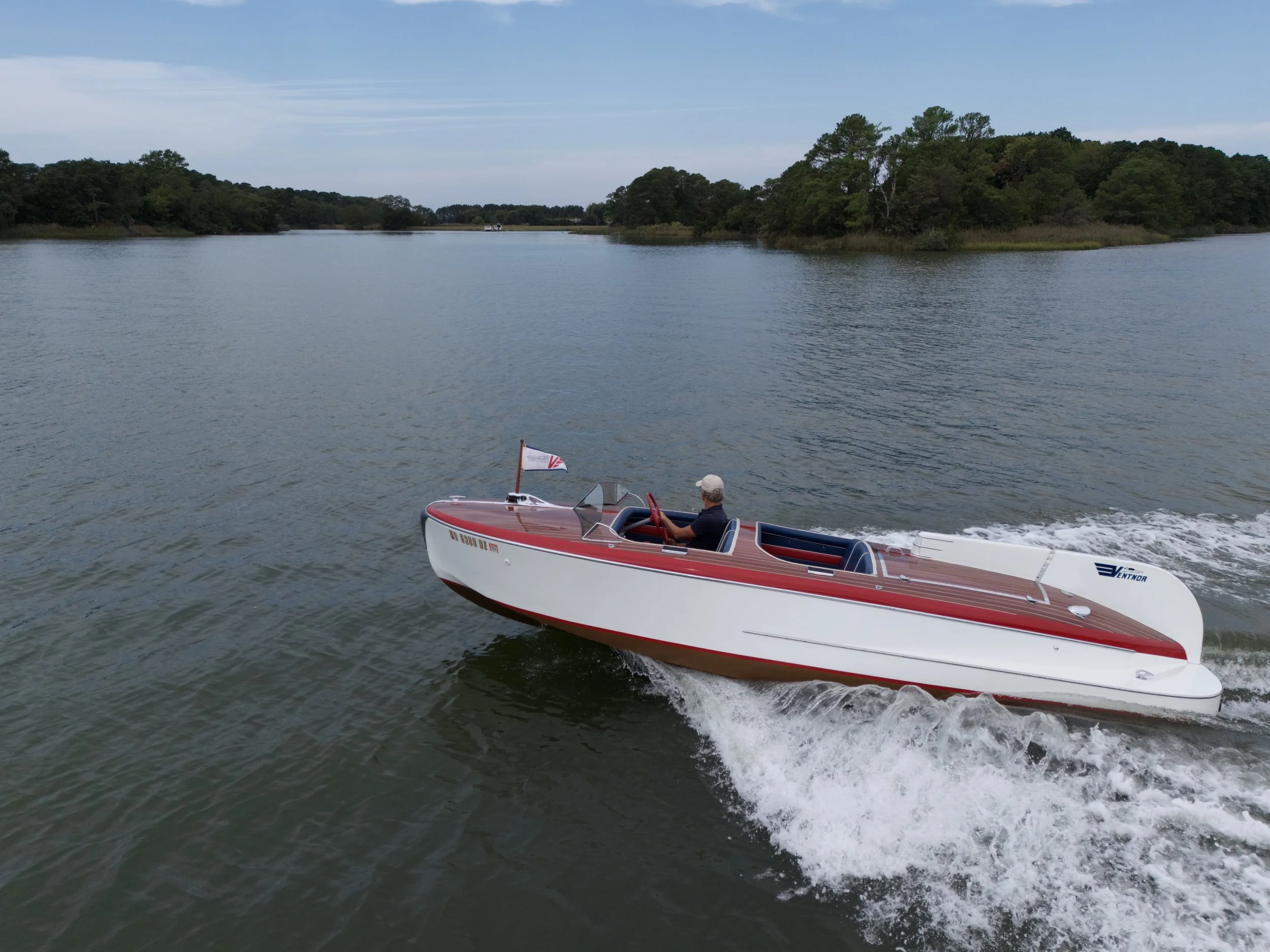
Sightlines Aerial provides professional drone imaging services for boat and vessel sales, maintenance, and documentation. Using high-resolution aerial photography and video, we capture clear views of hulls, decks, rigging, and overall condition from angles that are difficult to reach from docks or shore.
Our services help brokers, marinas, and owners showcase vessels effectively, assess exterior condition, and document damage or repairs. Aerial visuals highlight layout, access, and setting—supporting stronger listings and more informed buyers.
All operations follow FAA regulations and maritime safety best practices, delivering reliable imagery that supports sales, service planning, and asset management.
-
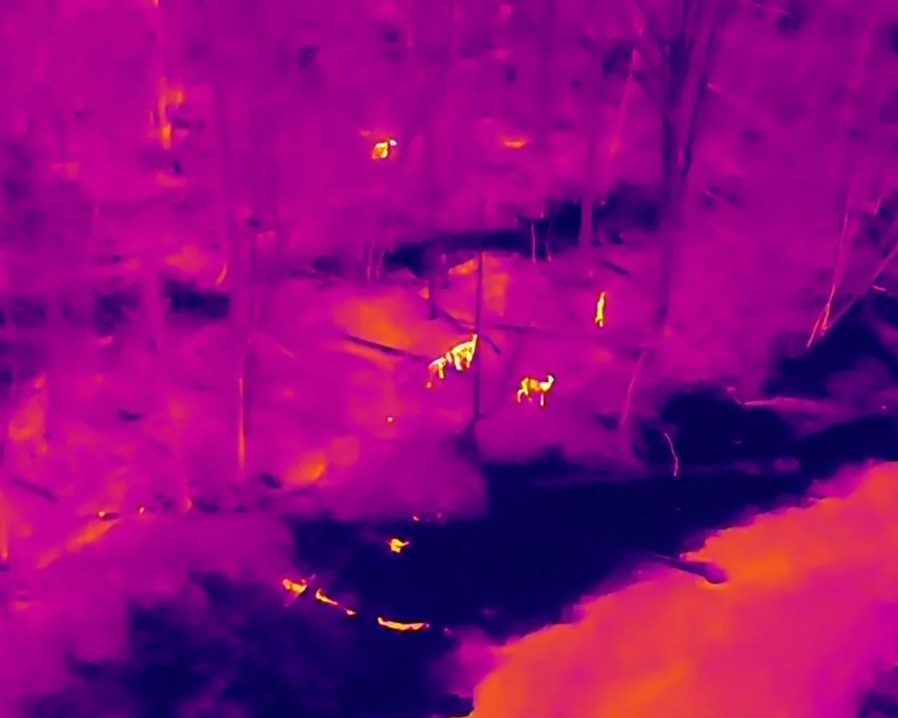
Property Census for Game Animals
Sightlines Aerial offers thermal drone surveys to help landowners and managers understand wildlife activity across their property. Our imaging technology detects animals hidden by vegetation, terrain, or low light, providing accurate insights that ground surveys often miss.
These surveys support population estimates, movement tracking, and habitat analysis without disturbing wildlife. They are ideal for conservation planning, seasonal monitoring, and long-term land management.
By combining advanced aerial technology with responsible flight practices, Sightlines Aerial delivers reliable data to support healthy herds and sustainable wildlife management.
services
Packages
*Custom Services Available
If you don’t see exactly what you need, we can tailor a service to match your goals, timeline, and budget. All flights are planned for safety, quality, and compliance with FAA Part 107 standards.
FAQ
Booking Window:
Real Estate: At least 2 business days
Vessel sales: At least 1 week
Property Wildlife Surveys: At least 1 week
Insurance Questions: Sightlines Aerial is fully licensed and insured.
Airspace Restrictions: There may be airspace restrictions near your project that require waivers from the FAA. Additional fees may apply.
File Formats: JPG, MP4
Editing Policy: Editing is done at a pre-negotiated rate above the quoted price for initial services.